
Carte topographique Darora
Carte interactive
Cliquez sur la carte pour afficher l’altitude.
À propos de cette carte
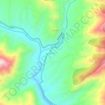
Nom : Carte topographique Darora, altitude, relief.
Altitude moyenne : 1 233 m
Altitude minimum : 1 042 m
Altitude maximum : 1 615 m
Autres cartes topographiques
Cliquez sur une carte pour visualiser sa topographie, son altitude et son relief.
Sherīngal
Pakistan > Khyber Pakhtunkhwa > Upper Dir District
Sherīngal, Upper Dir District, Malakand Division, Khyber Pakhtunkhwa, Pakistan
Altitude moyenne : 1 659 m