
Carte topographique Slater
Carte interactive
Cliquez sur la carte pour afficher l’altitude.
À propos de cette carte
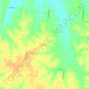
Nom : Carte topographique Slater, altitude, relief.
Lieu : Slater, Ballard County, Kentucky, United States (36.99644 -89.00923 37.03644 -88.96923)
Altitude moyenne : 135 m
Altitude minimum : 115 m
Altitude maximum : 152 m
Autres cartes topographiques
Cliquez sur une carte pour visualiser sa topographie, son altitude et son relief.
Barlow
United States > Kentucky > Ballard County
Barlow, Ballard County, Kentucky, United States
Altitude moyenne : 110 m
Kevil
United States > Kentucky > Ballard County
Kevil, Ballard County, Kentucky, United States
Altitude moyenne : 132 m
La Center
United States > Kentucky > Ballard County
La Center, Ballard County, Kentucky, United States
Altitude moyenne : 111 m
Wickliffe
United States > Kentucky > Ballard County
Wickliffe, Ballard County, Kentucky, United States
Altitude moyenne : 110 m