
Carte topographique Dewey Lake
Carte interactive
Cliquez sur la carte pour afficher l’altitude.
À propos de cette carte
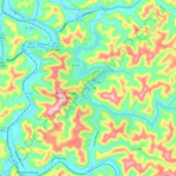
Nom : Carte topographique Dewey Lake, altitude, relief.
Altitude moyenne : 273 m
Altitude minimum : 181 m
Altitude maximum : 435 m
Autres cartes topographiques
Cliquez sur une carte pour visualiser sa topographie, son altitude et son relief.
Prestonsburg
United States > Kentucky > Floyd County > Prestonsburg > Prestonsburg
Prestonsburg, Floyd County, Kentucky, 41653, United States
Altitude moyenne : 274 m