
Carte topographique 广昌县工业园区
Carte interactive
Cliquez sur la carte pour afficher l’altitude.
À propos de cette carte
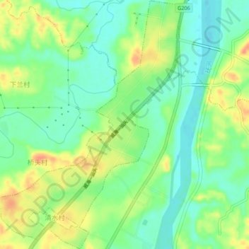
Nom : Carte topographique 广昌县工业园区, altitude, relief.
Lieu : 广昌县工业园区, 广昌县, 抚州市, 江西省, 中国 (26.85836 116.31202 26.89513 116.34285)
Altitude moyenne : 132 m
Altitude minimum : 114 m
Altitude maximum : 157 m
Autres cartes topographiques
Cliquez sur une carte pour visualiser sa topographie, son altitude et son relief.