
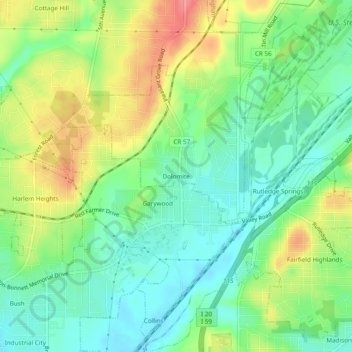
Carte topographique Dolomite
Carte interactive
Cliquez sur la carte pour afficher l’altitude.
À propos de cette carte
Nom : Carte topographique Dolomite, altitude, relief.
Altitude moyenne : 176 m
Altitude minimum : 145 m
Altitude maximum : 224 m
Autres cartes topographiques
Cliquez sur une carte pour visualiser sa topographie, son altitude et son relief.
Tuxedo Heights
United States > Alabama > Jefferson County > Birmingham
Tuxedo Heights, Birmingham, Jefferson County, Alabama, 35218, United States
Altitude moyenne : 174 m
Harriman Park
United States > Alabama > Jefferson County > Birmingham
Harriman Park, Birmingham, Jefferson County, Alabama, 35207, United States
Altitude moyenne : 181 m
Jefferson Hills
United States > Alabama > Jefferson County > Birmingham
Jefferson Hills, Birmingham, Jefferson County, Alabama, 35217, United States
Altitude moyenne : 186 m