
Carte topographique 炎陵县
Carte interactive
Cliquez sur la carte pour afficher l’altitude.
À propos de cette carte
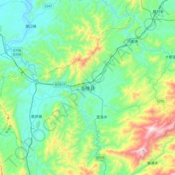
Nom : Carte topographique 炎陵县, altitude, relief.
Lieu : 炎陵县, 株洲市, 湖南省, 中国 (26.33301 113.60812 26.65301 113.92812)
Altitude moyenne : 465 m
Altitude minimum : 129 m
Altitude maximum : 1 594 m
周边相邻县市有,东接江西井冈山市和遂川县,南临本省桂东县,西界资兴市、永兴县和安仁县,北与茶陵县相连。炎陵为湖南重要林业县,有大院冷杉(资源冷杉)。传说炎帝神农氏崩葬于境内鹿原陂,故于1994年4月5日更名炎陵。主要旅游景点有炎帝陵和神农谷国家森林公园,还有湖南第一峰-神农峰(海拔2115.2m)。
Autres cartes topographiques
Cliquez sur une carte pour visualiser sa topographie, son altitude et son relief.