
Carte topographique Blencathra
Carte interactive
Cliquez sur la carte pour afficher l’altitude.
Blencathra
The Northern Fells make up a roughly circular upland area about 10 miles (16 km) wide. At the centre is the marshy depression of Skiddaw Forest — a treeless plateau at an altitude of 1,300 ft (396 m.) — and flowing outward from here are the rivers which divide the area into three sectors. The southeastern sector, between the Glenderaterra Beck and the River Caldew, contains Blencathra and its satellites.
À propos de cette carte
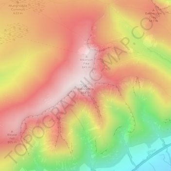
Nom : Carte topographique Blencathra, altitude, relief.
Altitude moyenne : 577 m
Altitude minimum : 160 m
Altitude maximum : 854 m
Autres cartes topographiques
Cliquez sur une carte pour visualiser sa topographie, son altitude et son relief.
River Glenderamackin
United Kingdom > England > Westmorland and Furness > Threlkeld
Altitude moyenne : 346 m