

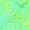
Carte topographique Nilamboor
Cliquez sur la carte pour afficher l’altitude.
À propos de cette carte

Nom : Carte topographique Nilamboor, altitude, relief.
Lieu : Nilamboor, Nilambur, Malappuram, Kerala, India (11.25760 76.09207 11.52928 76.45989)
Altitude moyenne : 551 m
Altitude minimum : 3 m
Altitude maximum : 2 442 m
Autres cartes topographiques
Cliquez sur une carte pour visualiser sa topographie, son altitude et son relief.


Nilambur
The 2,554 m (8,379 ft) m high Mukurthi peak, which is situated in the border of Nilambur Taluk and Ooty Taluk, and is also the fifth-highest peak in South India as well as the third-highest in Kerala after Anamudi (2,696 m [8,845 ft]) and Meesapulimala (2,651 m [8,698 ft]), is the highest point of elevation in…
Altitude moyenne : 33 m