
Carte topographique Mathra
Carte interactive
Cliquez sur la carte pour afficher l’altitude.
À propos de cette carte
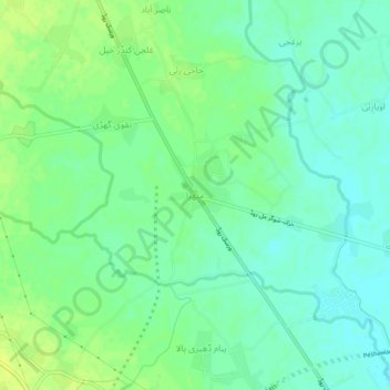
Nom : Carte topographique Mathra, altitude, relief.
Altitude moyenne : 330 m
Altitude minimum : 322 m
Altitude maximum : 338 m
Autres cartes topographiques
Cliquez sur une carte pour visualiser sa topographie, son altitude et son relief.
University Town
Pakistan > Khyber Pakhtunkhwa > Peshāwar District > Peshawar City Tehsil
University Town, Peshawar City Tehsil, Peshawar District, Peshawar Division, Khyber Pakhtunkhwa, 25000, Pakistan
Altitude moyenne : 371 m