Carte topographique Tiger
Cliquez sur la carte pour afficher l’altitude.
Tiger
Tiger lies in the extreme northeastern part of the state, just a few miles west of the Georgia-South Carolina border, and a few miles south of the Georgia-North Carolina border. The town's elevation is 1,962 feet (598 m), with several wooded hilltops reaching elevations of 2,100 to 2,200 feet. The town sits at the base of 2,856-foot Tiger Mountain, a prominent Blue Ridge Mountain peak.
À propos de cette carte
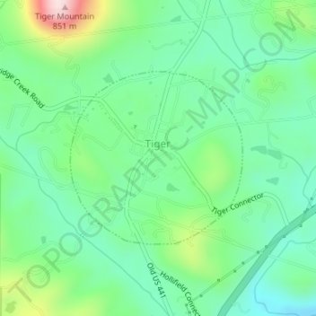
Nom : Carte topographique Tiger, altitude, relief.
Lieu : Tiger, Rabun County, Georgia, United States (34.83827 -83.44207 34.85307 -83.42409)
Altitude moyenne : 608 m
Altitude minimum : 506 m
Altitude maximum : 859 m
Autres cartes topographiques
Cliquez sur une carte pour visualiser sa topographie, son altitude et son relief.

Clayton
United States > Georgia > Rabun County > Clayton
According to the United States Census Bureau, the city has a total area of 3.1 square miles (8.0 km2), all of it land. The elevation of Clayton's downtown area is 1,925 feet (587 m). A number of hilltops within the city limits exceed 2,200 feet.
Altitude moyenne : 634 m