Carte topographique Collin County
Cliquez sur la carte pour afficher l’altitude.
À propos de cette carte

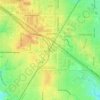
Nom : Carte topographique Collin County, altitude, relief.
Lieu : Collin County, Texas, United States (32.98150 -96.84413 33.40548 -96.29535)
Altitude moyenne : 191 m
Altitude minimum : 131 m
Altitude maximum : 252 m
Autres cartes topographiques
Cliquez sur une carte pour visualiser sa topographie, son altitude et son relief.
Austin
United States > Texas > Travis County > Austin
The elevation of Austin varies from 425 feet (130 m) to approximately 1,000 feet (305 m) above sea level. Due to the fact it straddles the Balcones Fault, much of the eastern part of the city is flat, with heavy clay and loam soils, whereas the western part and western suburbs consist of rolling hills on the…
Altitude moyenne : 203 m
Inks Lake State Park
United States > Texas > Burnet County > Burnet
Conservation Pool Elevation usually stays around 888.22 ft. msl; however, this lake does fluctuate about 1 foot annually. Inks lake water clarity can be seen as clear to slightly stained mostly throughout the year. It tends to have higher turbidity during the rainy season due to excessive amounts of runoff.
Altitude moyenne : 294 m













Guadalupe Peak
United States > Texas > Culberson County
Guadalupe Peak, also known as Signal Peak, is the highest natural point in Texas, with an elevation of 8,751 feet (2,667 m) above sea level. It is located in Guadalupe Mountains National Park, and is part of the Guadalupe Mountains range in southeastern New Mexico and West Texas. The mountain is about 90 miles…
Altitude moyenne : 2 150 m


Anthony
United States > Texas > El Paso County
Anthony has a desert climate, with a high degree of diurnal temperature variation due to the relatively high elevation and aridity.
Altitude moyenne : 1 173 m


Knott
United States > Texas > Howard County
Knott is an unincorporated community in northwestern Howard County, Texas, United States. It lies along FM 846 northwest of the city of Big Spring, the county seat of Howard County. Its elevation is 2,612 feet (796 m). Although Knott is unincorporated, it has a post office, with the ZIP code of 79748.
Altitude moyenne : 794 m









Enchanted Rock
United States > Texas > Llano County
Enchanted Rock is a pink granite mountain located in the Llano Uplift about 17 miles (27 km) north of Fredericksburg, Texas and 24 miles (39 km) south of Llano, Texas, United States. Enchanted Rock State Natural Area, which includes Enchanted Rock and surrounding land, spans the border between Gillespie and…
Altitude moyenne : 453 m


Padre Island National Seashore
United States > Texas > Kenedy County > Corpus Christi
Altitude moyenne : 5 m