
Faire un don
Équipez-vous pour votre prochaine aventure :
En tant que Partenaire Amazon, ce site perçoit une commission sur les achats éligibles sans surcoût pour vous.
Carte topographique Magal
Cliquez sur la carte pour afficher l’altitude.
Faire un don
Équipez-vous pour votre prochaine aventure :
En tant que Partenaire Amazon, ce site perçoit une commission sur les achats éligibles sans surcoût pour vous.
Magal
Kibbutz Magal was founded in 1953 as a Nahal settlement on a hill overlooking the Samaria hills and what was then the border with Jordan. The kibbutz sits on a hill known from the War of Independence as the "86th Regiment"—on any elevation of the hill above the sea level (86 meters). The kibbutz was founded by the Tzofim battalion, but when they left, Nahal members began to settle there, which continued to reach it until the 1980s.
Faire un don
Équipez-vous pour votre prochaine aventure :
En tant que Partenaire Amazon, ce site perçoit une commission sur les achats éligibles sans surcoût pour vous.
À propos de cette carte
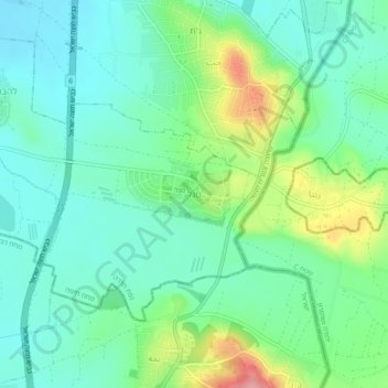
Nom : Carte topographique Magal, altitude, relief.
Altitude moyenne : 65 m
Altitude minimum : 31 m
Altitude maximum : 150 m
Faire un don
Équipez-vous pour votre prochaine aventure :
En tant que Partenaire Amazon, ce site perçoit une commission sur les achats éligibles sans surcoût pour vous.