
Carte topographique Cherrapunji (Sohra)
Carte interactive
Cliquez sur la carte pour afficher l’altitude.
À propos de cette carte
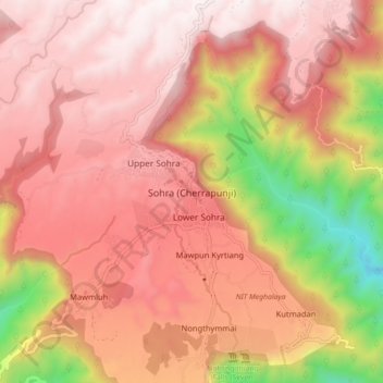
Nom : Carte topographique Cherrapunji (Sohra), altitude, relief.
Altitude moyenne : 1 248 m
Altitude minimum : 332 m
Altitude maximum : 1 677 m
It has an average elevation of 1,430 metres (4,690 ft) and sits on a plateau in the southern part of the Khasi Hills, facing the plains of Bangladesh. The plateau rises 660 meters above the surrounding valleys.