
Carte topographique Königshofen an der Kahl
Carte interactive
Cliquez sur la carte pour afficher l’altitude.
À propos de cette carte
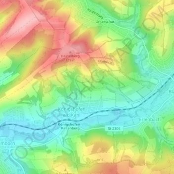
Nom : Carte topographique Königshofen an der Kahl, altitude, relief.
Altitude moyenne : 241 m
Altitude minimum : 174 m
Altitude maximum : 330 m
Autres cartes topographiques
Cliquez sur une carte pour visualiser sa topographie, son altitude et son relief.
Daxberg
Deutschland > Bayern > Landkreis Aschaffenburg > Mömbris
Daxberg, Mömbris, Landkreis Aschaffenburg, Bayern, Deutschland
Altitude moyenne : 268 m