
Carte topographique Tabia Tsaka
Carte interactive
Cliquez sur la carte pour afficher l’altitude.
Tabia Tsaka
Zabuye Lake is a hypersaline, landlocked soda lake located at an elevation of 4,400 metres (14,400 ft) in the Shigatse Prefecture of Tibet Autonomous Region, 1,050 km (650 mi) from Lhasa. The lake gives its name to the mineral zabuyelite (lithium carbonate, Li2CO3), which was discovered here in 1987 and has been mined since 2004–2005. In 2008, the salt mine at the lake was regarded as the major source of lithium in China.
À propos de cette carte
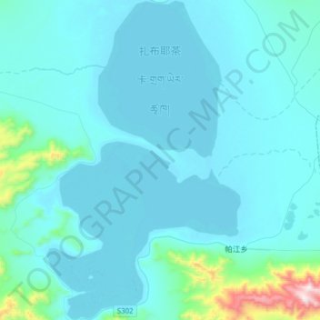
Nom : Carte topographique Tabia Tsaka, altitude, relief.
Lieu : Tabia Tsaka, Drongpa County, Shigatse Prefecture, Tibet, China (31.24569 83.94160 31.51068 84.13040)
Altitude moyenne : 4 497 m
Altitude minimum : 4 421 m
Altitude maximum : 5 445 m