
Carte topographique Rackerby
Cliquez sur la carte pour afficher l’altitude.
À propos de cette carte
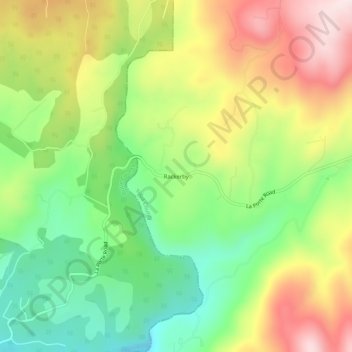
Nom : Carte topographique Rackerby, altitude, relief.
Lieu : Rackerby, Yuba County, California, 95972, United States (39.42001 -121.35790 39.46001 -121.31790)
Altitude moyenne : 469 m
Altitude minimum : 276 m
Altitude maximum : 710 m
Autres cartes topographiques
Cliquez sur une carte pour visualiser sa topographie, son altitude et son relief.
Beale AFB
United States > California > Yuba County
On 15 October 1964, the Department of Defense announced that Beale would be the home of the new, supersonic reconnaissance aircraft, the SR-71 Blackbird. The provisional 4200th Strategic Reconnaissance Wing (4200 SRW) activated on 1 January 1965 in preparation for the realignment, and the new wing received its…
Altitude moyenne : 69 m