
Faire un don
Équipez-vous pour votre prochaine aventure :
En tant que Partenaire Amazon, ce site perçoit une commission sur les achats éligibles sans surcoût pour vous.
Carte topographique Bhanu Chak
Cliquez sur la carte pour afficher l’altitude.
Faire un don
Équipez-vous pour votre prochaine aventure :
En tant que Partenaire Amazon, ce site perçoit une commission sur les achats éligibles sans surcoût pour vous.
À propos de cette carte
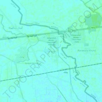
Nom : Carte topographique Bhanu Chak, altitude, relief.
Altitude moyenne : 222 m
Altitude minimum : 219 m
Altitude maximum : 226 m
Faire un don
Équipez-vous pour votre prochaine aventure :
En tant que Partenaire Amazon, ce site perçoit une commission sur les achats éligibles sans surcoût pour vous.
Autres cartes topographiques
Cliquez sur une carte pour visualiser sa topographie, son altitude et son relief.
Afshan Colony
Pakistan > Punjab > Rawalpindi District > Rawalpindi Cantonment
Altitude moyenne : 518 m
Faisalabad City Tehsil
The soil consists of young stratified silt loam or very fine sand loam which makes the subsoil weak in structure with common kankers at only five feet. The course of the rivers within Faisalabad is winding and often subject to frequent alternations. In the rainy season, the currents are very strong. This leads…
Altitude moyenne : 185 m
Faire un don
Équipez-vous pour votre prochaine aventure :
En tant que Partenaire Amazon, ce site perçoit une commission sur les achats éligibles sans surcoût pour vous.
Faire un don
Équipez-vous pour votre prochaine aventure :
En tant que Partenaire Amazon, ce site perçoit une commission sur les achats éligibles sans surcoût pour vous.
Faire un don
Équipez-vous pour votre prochaine aventure :
En tant que Partenaire Amazon, ce site perçoit une commission sur les achats éligibles sans surcoût pour vous.
Lalamusa
Pakistan > Punjab > Gujrat District
Lalamusa is situated on the Grand Trunk Road (National Highway 5). It is geographically located at latitude (32.7 degrees) 32° 42' 0" North of the Equator and longitude (73.96 degrees) 73° 57' 35" East of the Prime Meridian on the Map of the world and lies at an altitude of about 250 meters.
Altitude moyenne : 254 m
Ravi River
The Ravi River originates in the Himalayas in the Multhan tehsil of Kangra district of Himachal Pradesh, India. It follows a north-westerly course and is a perennial river. It is the smallest of the five Punjab rivers that rise from glacier fields at an elevation of 14,000 feet (4,300 m), on the southern side…
Altitude moyenne : 171 m
Faisalabad City Tehsil
The soil consists of young stratified silt loam or very fine sand loam which makes the subsoil weak in structure with common kankers at only five feet. The course of the rivers within Faisalabad is winding and often subject to frequent alternations. In the rainy season, the currents are very strong. This leads…
Altitude moyenne : 185 m
Faire un don
Équipez-vous pour votre prochaine aventure :
En tant que Partenaire Amazon, ce site perçoit une commission sur les achats éligibles sans surcoût pour vous.
Faire un don
Équipez-vous pour votre prochaine aventure :
En tant que Partenaire Amazon, ce site perçoit une commission sur les achats éligibles sans surcoût pour vous.
Faire un don
Équipez-vous pour votre prochaine aventure :
En tant que Partenaire Amazon, ce site perçoit une commission sur les achats éligibles sans surcoût pour vous.
Faire un don
Équipez-vous pour votre prochaine aventure :
En tant que Partenaire Amazon, ce site perçoit une commission sur les achats éligibles sans surcoût pour vous.
Lalamusa
Pakistan > Punjab > Gujrat District
Lalamusa is situated on the Grand Trunk Road (National Highway 5). It is geographically located at latitude (32.7 degrees) 32° 42' 0" North of the Equator and longitude (73.96 degrees) 73° 57' 35" East of the Prime Meridian on the Map of the world and lies at an altitude of about 250 meters.
Altitude moyenne : 254 m
Faire un don
Équipez-vous pour votre prochaine aventure :
En tant que Partenaire Amazon, ce site perçoit une commission sur les achats éligibles sans surcoût pour vous.
Pakpattan District
Malka Hans is the ancient famous town near Pakpattan in Pakpattan District located between Pakpattan and Sahiwal on Sahiwal Road. Malka Hans is located at 30°25′26.4″N 73°16′33.6″E / 30.424000°N 73.276000°E / 30.424000; 73.276000 at an altitude of 150 metres (490 ft).
Altitude moyenne : 162 m
Faire un don
Équipez-vous pour votre prochaine aventure :
En tant que Partenaire Amazon, ce site perçoit une commission sur les achats éligibles sans surcoût pour vous.
Faire un don
Équipez-vous pour votre prochaine aventure :
En tant que Partenaire Amazon, ce site perçoit une commission sur les achats éligibles sans surcoût pour vous.
Faire un don
Équipez-vous pour votre prochaine aventure :
En tant que Partenaire Amazon, ce site perçoit une commission sur les achats éligibles sans surcoût pour vous.
Faire un don
Équipez-vous pour votre prochaine aventure :
En tant que Partenaire Amazon, ce site perçoit une commission sur les achats éligibles sans surcoût pour vous.
Faire un don
Équipez-vous pour votre prochaine aventure :
En tant que Partenaire Amazon, ce site perçoit une commission sur les achats éligibles sans surcoût pour vous.
Faisalabad City Tehsil
The soil consists of young stratified silt loam or very fine sand loam which makes the subsoil weak in structure with common kankers at only five feet. The course of the rivers within Faisalabad is winding and often subject to frequent alternations. In the rainy season, the currents are very strong. This leads…
Altitude moyenne : 185 m
Faire un don
Équipez-vous pour votre prochaine aventure :
En tant que Partenaire Amazon, ce site perçoit une commission sur les achats éligibles sans surcoût pour vous.
Faire un don
Équipez-vous pour votre prochaine aventure :
En tant que Partenaire Amazon, ce site perçoit une commission sur les achats éligibles sans surcoût pour vous.
Gujujranwala City Tehsil
Gujranwala sits at the heart of the Rechna Doab, a strip of land between the Chenab in the north, and Ravi River in the south. Gujranwala is also part of the Majha, a historical region of northern Punjab. The city was built upon the plains of Punjab, and the surrounding region is an unbroken plain devoid of…
Altitude moyenne : 225 m
Faire un don
Équipez-vous pour votre prochaine aventure :
En tant que Partenaire Amazon, ce site perçoit une commission sur les achats éligibles sans surcoût pour vous.
Faisalabad City Tehsil
The soil consists of young stratified silt loam or very fine sand loam which makes the subsoil weak in structure with common kankers at only five feet. The course of the rivers within Faisalabad is winding and often subject to frequent alternations. In the rainy season, the currents are very strong. This leads…
Altitude moyenne : 185 m
Faire un don
Équipez-vous pour votre prochaine aventure :
En tant que Partenaire Amazon, ce site perçoit une commission sur les achats éligibles sans surcoût pour vous.
Faire un don
Équipez-vous pour votre prochaine aventure :
En tant que Partenaire Amazon, ce site perçoit une commission sur les achats éligibles sans surcoût pour vous.
Faire un don
Équipez-vous pour votre prochaine aventure :
En tant que Partenaire Amazon, ce site perçoit une commission sur les achats éligibles sans surcoût pour vous.
Faire un don
Équipez-vous pour votre prochaine aventure :
En tant que Partenaire Amazon, ce site perçoit une commission sur les achats éligibles sans surcoût pour vous.
Faire un don
Équipez-vous pour votre prochaine aventure :
En tant que Partenaire Amazon, ce site perçoit une commission sur les achats éligibles sans surcoût pour vous.
Faire un don
Équipez-vous pour votre prochaine aventure :
En tant que Partenaire Amazon, ce site perçoit une commission sur les achats éligibles sans surcoût pour vous.