
Carte topographique Forstberg
Carte interactive
Cliquez sur la carte pour afficher l’altitude.
À propos de cette carte
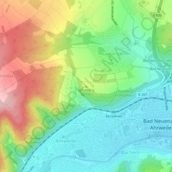
Nom : Carte topographique Forstberg, altitude, relief.
Altitude moyenne : 173 m
Altitude minimum : 95 m
Altitude maximum : 305 m
Autres cartes topographiques
Cliquez sur une carte pour visualiser sa topographie, son altitude et son relief.
Heimersheim
Deutschland > Rheinland-Pfalz > Bad Neuenahr-Ahrweiler > Heimersheim
Heimersheim, Bad Neuenahr-Ahrweiler, Landkreis Ahrweiler, Rheinland-Pfalz, Deutschland
Altitude moyenne : 206 m
Heppingen
Deutschland > Rheinland-Pfalz > Bad Neuenahr-Ahrweiler > Heppingen
Heppingen, Bad Neuenahr-Ahrweiler, Landkreis Ahrweiler, Rheinland-Pfalz, Deutschland
Altitude moyenne : 131 m