
Carte topographique Sawley
Cliquez sur la carte pour afficher l’altitude.
À propos de cette carte
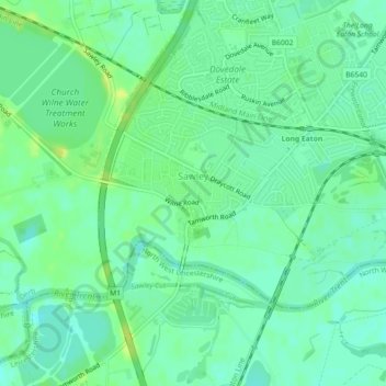
Nom : Carte topographique Sawley, altitude, relief.
Lieu : Sawley, Erewash, Derbyshire, England, United Kingdom (52.87238 -1.31098 52.88848 -1.26611)
Altitude moyenne : 32 m
Altitude minimum : 25 m
Altitude maximum : 40 m
Autres cartes topographiques
Cliquez sur une carte pour visualiser sa topographie, son altitude et son relief.
Stanley
United Kingdom > England > Derbyshire > Erewash
The Church gates commemorate Queen Victoria's Golden Jubilee of 1887, and the churchyard contains a memorial (erected in 2004) to the five aircrew who lost their lives when an experimental high-altitude RAF Wellington Bomber disintegrated above Stanley in 1942 following a loss of cabin pressure.
Altitude moyenne : 100 m