
Carte topographique Chanderi
Carte interactive
Cliquez sur la carte pour afficher l’altitude.
À propos de cette carte
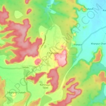
Nom : Carte topographique Chanderi, altitude, relief.
Altitude moyenne : 440 m
Altitude minimum : 362 m
Altitude maximum : 536 m
Chanderi is located at 24°43′N 78°08′E / 24.72°N 78.13°E / 24.72; 78.13. It has an average elevation of 456 metres (1496 feet).