
Carte topographique Drymen
Carte interactive
Cliquez sur la carte pour afficher l’altitude.
À propos de cette carte
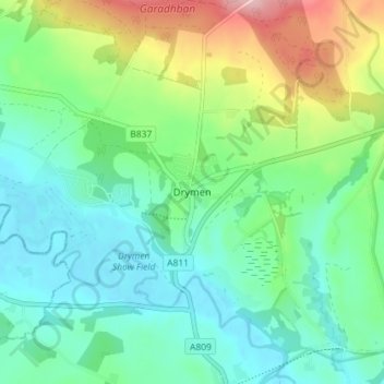
Nom : Carte topographique Drymen, altitude, relief.
Lieu : Drymen, Stirling, Scotland, G63 0BJ, United Kingdom (56.04553 -4.47200 56.08553 -4.43200)
Altitude moyenne : 59 m
Altitude minimum : 8 m
Altitude maximum : 186 m
Autres cartes topographiques
Cliquez sur une carte pour visualiser sa topographie, son altitude et son relief.
Loch Katrine
United Kingdom > Scotland > Stirling
Loch Katrine, Stirling, Scotland, United Kingdom
Altitude moyenne : 349 m
Ben Lomond
United Kingdom > Scotland > Stirling
Ben Lomond, Stirling, Scotland, G63 0AR, United Kingdom
Altitude moyenne : 575 m