
Carte topographique Томилова Гора
Carte interactive
Cliquez sur la carte pour afficher l’altitude.
À propos de cette carte
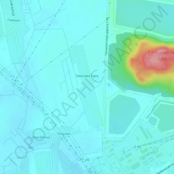
Nom : Carte topographique Томилова Гора, altitude, relief.
Altitude moyenne : 161 m
Altitude minimum : 145 m
Altitude maximum : 264 m
Autres cartes topographiques
Cliquez sur une carte pour visualiser sa topographie, son altitude et son relief.
Кутнево
Беларусь > Минская область > Солигорский район > Чижевичский сельский Совет
Кутнево, Чижевичский сельский Совет, Солигорский район, Минская область, Беларусь
Altitude moyenne : 155 m