
Carte topographique Davis
Carte interactive
Cliquez sur la carte pour afficher l’altitude.
Davis
Davis lies in the Sacramento Valley, the northern portion of the Central Valley, in Northern California, at an elevation of about 52 feet (16 m) above sea level.
À propos de cette carte
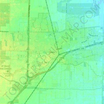
Nom : Carte topographique Davis, altitude, relief.
Lieu : Davis, Yolo County, California, 95616, United States (38.50538 -121.78458 38.58538 -121.70458)
Altitude moyenne : 15 m
Altitude minimum : 7 m
Altitude maximum : 23 m