
Carte topographique Hucknall
Cliquez sur la carte pour afficher l’altitude.
Hucknall
Hucknall Airfield, built in 1916, became RAF Hucknall. From 1927, Rolls-Royce began using the airfield for flight tests. During World War II, the aerodrome at Hucknall launched the first flight of a P-51 Mustang fitted with a Rolls-Royce Merlin Engine. The Merlin, replacing the earlier Allison V-1710 engine, allowed the Mustang air frame to reach its full potential and achieve spectacular high-altitude performance.
À propos de cette carte
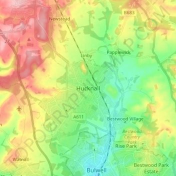
Nom : Carte topographique Hucknall, altitude, relief.
Altitude moyenne : 104 m
Altitude minimum : 44 m
Altitude maximum : 186 m