
Carte topographique Gorilla Circus Regents Park Flying Trapeze School
Carte interactive
Cliquez sur la carte pour afficher l’altitude.
À propos de cette carte
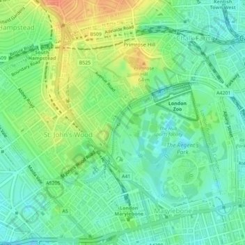
Nom : Carte topographique Gorilla Circus Regents Park Flying Trapeze School, altitude, relief.
Altitude moyenne : 41 m
Altitude minimum : 24 m
Altitude maximum : 68 m