
Carte topographique chelad kochappilly thodu
Carte interactive
Cliquez sur la carte pour afficher l’altitude.
À propos de cette carte
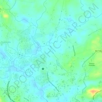
Nom : Carte topographique chelad kochappilly thodu, altitude, relief.
Altitude moyenne : 28 m
Altitude minimum : 18 m
Altitude maximum : 55 m
Autres cartes topographiques
Cliquez sur une carte pour visualiser sa topographie, son altitude et son relief.
Kothamangalam
India > Kerala > Kothamangalam
Kothamangalam, Ernakulam district, Kerala, 686666, India
Altitude moyenne : 34 m