

Carte topographique Epping Forest
Cliquez sur la carte pour afficher l’altitude.
Epping Forest
It lies on a ridge between the valleys of the rivers Lea and Roding. It contains areas of woodland, grassland, heath, streams, bogs, and ponds, and its elevation and thin gravelly soil (the result of glaciation) historically made it less suitable for agriculture. The forest was historically managed as a common; the land was held by a number of local landowners who exercised economic rights over aspects such as timber, while local commoners had grazing and other rights. It was designated a royal forest, meaning that only the monarch had the right to hunt deer.
À propos de cette carte
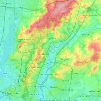
Nom : Carte topographique Epping Forest, altitude, relief.
Altitude moyenne : 44 m
Altitude minimum : 7 m
Altitude maximum : 121 m