
Carte topographique Cedarville Station
Carte interactive
Cliquez sur la carte pour afficher l’altitude.
À propos de cette carte
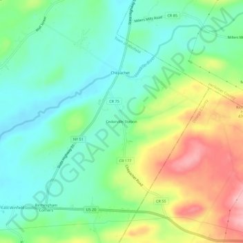
Nom : Carte topographique Cedarville Station, altitude, relief.
Altitude moyenne : 412 m
Altitude minimum : 362 m
Altitude maximum : 504 m
Autres cartes topographiques
Cliquez sur une carte pour visualiser sa topographie, son altitude et son relief.
Chepachet
United States > New York > Herkimer County > Town of Winfield
Chepachet, Town of Winfield, Herkimer County, New York, United States
Altitude moyenne : 408 m
Birmingham Corners
United States > New York > Herkimer County > Town of Winfield
Birmingham Corners, Town of Winfield, Herkimer County, New York, 13491, United States
Altitude moyenne : 417 m
Woods Corners
United States > New York > Herkimer County > Town of Winfield
Woods Corners, Town of Winfield, Herkimer County, New York, 13491, United States
Altitude moyenne : 418 m