Géolocaliser

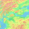
Carte topographique Scottish Borders

Cliquez sur la carte pour afficher l’altitude.

À propos de cette carte
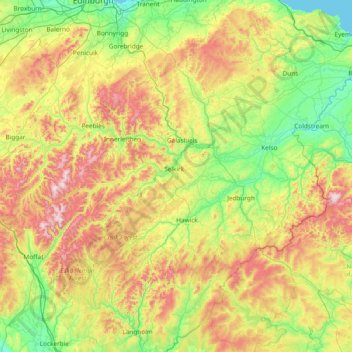
Nom : Carte topographique Scottish Borders, altitude, relief.

Lieu : Scottish Borders, Scotland, United Kingdom (55.10834 -3.53980 55.94662 -2.03321)

Altitude moyenne : 257 m

Altitude minimum : 0 m

Altitude maximum : 836 m

Autres cartes topographiques

Cliquez sur une carte pour visualiser sa topographie, son altitude et son relief.
Edinburgh

United Kingdom > Scotland > Edinburgh

Some have called Edinburgh the Athens of the North for a variety of reasons. The earliest comparison between the two cities showed that they had a similar topography, with the Castle Rock of Edinburgh performing a similar role to the Athenian Acropolis. Both of them had flatter, fertile agricultural land…

Altitude moyenne : 104 m
Glasgow

United Kingdom > Scotland > Glasgow City

Glasgow itself was reputed to have been founded by the Christian missionary Saint Mungo in the 6th century. He established a church on the Molendinar Burn, where the present Glasgow Cathedral stands, and in the following years Glasgow became a religious centre. Glasgow grew over the following centuries. The…

Altitude moyenne : 128 m
Scottish Highlands

United Kingdom > Scotland > Highland

The Scottish Highlands are renowned for their rugged, mountainous terrain that dominates much of the region. Stretching across the northern and central parts of Scotland, the landscape is shaped by ancient geological forces, including the Caledonian Orogeny, which caused significant tectonic collisions…

Altitude moyenne : 907 m
Strathaven

United Kingdom > Scotland > South Lanarkshire

Altitude moyenne : 216 m

Ayrshire

United Kingdom > Scotland

Altitude moyenne : 141 m

Eddleston

United Kingdom > Scotland > Scottish Borders

Altitude moyenne : 282 m

Loch Torridon

United Kingdom > Scotland > Diabaig

Altitude moyenne : 36 m

Glencoe

United Kingdom > Scotland > Highland

Altitude moyenne : 114 m

Iona

United Kingdom > Scotland

Altitude moyenne : 9 m

Aberdeen

United Kingdom > Scotland > Aberdeen

Two weather stations collect climate data for the area, Aberdeen/Dyce Airport, and Craibstone. Both are about 4 1⁄2 miles (7 km) to the north west of the city centre, and given that they are in close proximity to each other, exhibit very similar climatic regimes. Dyce tends to have marginally warmer daytime…

Altitude moyenne : 52 m
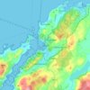
Oban

United Kingdom > Scotland > Argyll and Bute

Altitude moyenne : 52 m

Mull of Kintyre

United Kingdom > Scotland

Ailsa Craig and the County Antrim coast of Ulster and Rathlin Island are all clearly visible from the Mull. On clearer days it is also possible to make out Malin Head in Inishowen in County Donegal in the west of Ulster, and the Ayrshire coast on the other side of Ailsa Craig. Other islands in the Firth of…

Altitude moyenne : 84 m

Buachaille Etive Mor

United Kingdom > Scotland

Altitude moyenne : 585 m

Renfrew

United Kingdom > Scotland > Renfrewshire

Altitude moyenne : 16 m

Kilmarnock

United Kingdom > Scotland > East Ayrshire

Altitude moyenne : 56 m

Stornoway

United Kingdom > Scotland > Western Isles

Altitude moyenne : 34 m

Winchburgh

United Kingdom > Scotland > West Lothian

Altitude moyenne : 74 m

Montrose

United Kingdom > Scotland > Angus

Montrose occupies a position on the North Bank of Montrose Basin at the mouth of the River South Esk on the East Coast of Scotland, 11 miles (18 km) NNE of Arbroath, 19 miles (31 km) SW of Stonehaven, and 7.2 miles (12 km) ESE of Brechin. The town lies 62.2 miles (100 km) NNE of Edinburgh, and 373.2 miles (601…

Altitude moyenne : 22 m
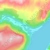
Invermoriston

United Kingdom > Scotland > Highland

Altitude moyenne : 212 m

Paisley

United Kingdom > Scotland > Renfrewshire

Altitude moyenne : 33 m

Dunblane

United Kingdom > Scotland > Stirling

Altitude moyenne : 117 m

Bellshill

United Kingdom > Scotland > North Lanarkshire

Altitude moyenne : 73 m

Lossiemouth

United Kingdom > Scotland > Moray

Altitude moyenne : 3 m

Fishcross

United Kingdom > Scotland > Clackmannanshire

Altitude moyenne : 38 m

Cushnie

United Kingdom > Scotland > Aberdeenshire

Altitude moyenne : 146 m

Newcastleton

United Kingdom > Scotland > Scottish Borders

Altitude moyenne : 164 m

Kirkcaldy

United Kingdom > Scotland > Fife

Towards the end of the 16th century, a detailed assessment on the size of the townscape was carried out. The first estimate of the parish population in 1639 was between 3,000 and 3,200 and around 3,400 by 1691. At the beginning of the 18th century, the population declined. A census by Webster's Topographical…

Altitude moyenne : 50 m
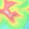
Argyll and Bute

United Kingdom > Scotland

Altitude moyenne : 683 m

The Campsie Fells

United Kingdom > Scotland

Altitude moyenne : 431 m

Western Isles

United Kingdom > Scotland

Altitude moyenne : 23 m

Ben Lomond

United Kingdom > Scotland > Stirling

Altitude moyenne : 575 m

Inchmickery

United Kingdom > Scotland

Altitude moyenne : 0 m

Ailsa Craig

United Kingdom > Scotland

In a small glen above Ailsa Castle, a small freshwater body known as the Garry Loch is located at an altitude of 247 m (810 ft), with a depth of at least 17 feet.

Altitude moyenne : 14 m

Banffshire

United Kingdom > Scotland

Altitude moyenne : 191 m

Stirlingshire

United Kingdom > Scotland

Altitude moyenne : 222 m

East Kilbride

United Kingdom > Scotland > South Lanarkshire

The earliest-known evidence of occupation in the area dates as far back as the late Neolithic and Early Bronze Age, as archaeological investigation has demonstrated that burial cairns in the district began as ceremonial or ritual sites of burial during the Neolithic, with the use of cup-marked, and other…

Altitude moyenne : 174 m

Glen Dochart

United Kingdom > Scotland

Altitude moyenne : 469 m

Auchencorth Moss

United Kingdom > Scotland

Altitude moyenne : 281 m

Denton Burn

United Kingdom > Scotland

Altitude moyenne : 154 m

Taynish Island

United Kingdom > Scotland

Altitude moyenne : 11 m

Devil's Beef Tub

United Kingdom > Scotland

Altitude moyenne : 376 m

Grey Mare's Tail

United Kingdom > Scotland

Altitude moyenne : 466 m

Meall Aundrary

United Kingdom > Scotland

Altitude moyenne : 194 m

River Kerry

United Kingdom > Scotland

Altitude moyenne : 118 m

Abhainn a' Ghlinne Ghil

United Kingdom > Scotland

Altitude moyenne : 138 m

Burian Hole

United Kingdom > Scotland

Altitude moyenne : 36 m

Papa

United Kingdom > Scotland

Altitude moyenne : 2 m

Sgùrr na Stri

United Kingdom > Scotland

Altitude moyenne : 92 m

Braid Hill

United Kingdom > Scotland

Altitude moyenne : 353 m

Sutherland

United Kingdom > Scotland

Altitude moyenne : 109 m

Loch Urigill

United Kingdom > Scotland

Altitude moyenne : 172 m

Highland

United Kingdom > Scotland

Altitude moyenne : 402 m

Glen Croe

United Kingdom > Scotland

Altitude moyenne : 355 m

Inverness-shire

United Kingdom > Scotland

Altitude moyenne : 333 m

Barrnacarry Bay

United Kingdom > Scotland

Altitude moyenne : 32 m

Snap

United Kingdom > Scotland

Altitude moyenne : 3 m

Lanarkshire

United Kingdom > Scotland

Altitude moyenne : 183 m

Rubha nam Bùthan

United Kingdom > Scotland

Altitude moyenne : 15 m

The Minch

United Kingdom > Scotland

Altitude moyenne : 63 m

Firth of Clyde

United Kingdom > Scotland

Altitude moyenne : 0 m

St Magnus' Bay

United Kingdom > Scotland

Altitude moyenne : 6 m

Dundee

United Kingdom > Scotland > Dundee City

Dundee sits on the north bank of the Firth of Tay on the eastern, North Sea Coast of Scotland. The city lies 36.1 miles (58 km) NNE of Edinburgh and 360.6 miles (580 km) NNW of London. The built-up area occupies a roughly rectangular shape 8.3 miles (13 km) long by 2.5 miles (4 km) wide, aligned in an east to…

Altitude moyenne : 82 m
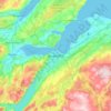
Inverness

United Kingdom > Scotland > Highland

Altitude moyenne : 163 m

Moffat

United Kingdom > Scotland > Dumfries and Galloway

Altitude moyenne : 225 m

Bridge of Weir

United Kingdom > Scotland > Renfrewshire

Altitude moyenne : 78 m

Kelso

United Kingdom > Scotland > Scottish Borders

Altitude moyenne : 79 m

Ben Rinnes

United Kingdom > Scotland > Moray

Altitude moyenne : 539 m

Whitebridge

United Kingdom > Scotland > Highland

Altitude moyenne : 223 m

Ayr

United Kingdom > Scotland > South Ayrshire

Altitude moyenne : 18 m

Aviemore

United Kingdom > Scotland > Highland

Altitude moyenne : 332 m

Peterhead

United Kingdom > Scotland > Aberdeenshire

Altitude moyenne : 17 m

Haddington

United Kingdom > Scotland > East Lothian

Altitude moyenne : 78 m

Scottish Highlands

United Kingdom > Scotland > Highland

The entire region was covered by ice sheets during the Pleistocene ice ages, save perhaps for a few nunataks. The complex geomorphology includes incised valleys and lochs carved by the action of mountain streams and ice, and a topography of irregularly distributed mountains whose summits have similar heights…

Altitude moyenne : 907 m
Ben A'an

United Kingdom > Scotland > Stirling

Ben A'an is a hill in the Trossachs in Scotland. The pointed peak of its west top (454 metres or 1,490 feet in elevation) resembles a small mountain.

Altitude moyenne : 283 m
Grampian Mountains

United Kingdom > Scotland > Highland

Altitude moyenne : 775 m

Tongue

United Kingdom > Scotland > Highland

Altitude moyenne : 91 m

Rockall

United Kingdom > Scotland > Western Isles

Altitude moyenne : 0 m

Portree

United Kingdom > Scotland > Highland

Altitude moyenne : 121 m

Acharacle

United Kingdom > Scotland > Highland

Altitude moyenne : 46 m

Dundreggan

United Kingdom > Scotland > Highland

Altitude moyenne : 250 m

Fens

United Kingdom > Scotland > Scottish Borders > St Boswells

Altitude moyenne : 96 m

Crossford

United Kingdom > Scotland > Fife

Altitude moyenne : 65 m

Longridge

United Kingdom > Scotland > West Lothian

Altitude moyenne : 217 m

Loch Ericht

United Kingdom > Scotland > Highland > Dalwhinnie

Altitude moyenne : 592 m

Dupplin Loch

United Kingdom > Scotland > Perth and Kinross > Perth

Altitude moyenne : 130 m

Campbeltown

United Kingdom > Scotland > Argyll and Bute

Altitude moyenne : 84 m

Gullane

United Kingdom > Scotland > East Lothian

Altitude moyenne : 16 m

Glen Pean

United Kingdom > Scotland > Highland

Altitude moyenne : 353 m

Équipez-vous pour votre prochaine aventure :

🧯Couvertures de survie - Protection thermique d’urgence
🦯Bâtons de randonnée - Bâtons réglables pour améliorer stabilité et endurance
🥣Popotes de camping - Ustensiles légers pour cuisiner en plein air
🧰Outils multifonctions - Outils polyvalents outdoor
⚡Barres Énergétiques - Snacks sains pour un coup de boost lors des montées rudes.

En tant que Partenaire Amazon, ce site perçoit une commission sur les achats éligibles sans surcoût pour vous.