
Carte topographique Lough Navar
Carte interactive
Cliquez sur la carte pour afficher l’altitude.
À propos de cette carte
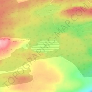
Nom : Carte topographique Lough Navar, altitude, relief.
Altitude moyenne : 232 m
Altitude minimum : 147 m
Altitude maximum : 294 m
Autres cartes topographiques
Cliquez sur une carte pour visualiser sa topographie, son altitude et son relief.
Brookeborough
United Kingdom > Northern Ireland > County Fermanagh
Brookeborough, County Fermanagh, Northern Ireland, BT94 4EZ, United Kingdom
Altitude moyenne : 97 m
Brattan's Hill
United Kingdom > Northern Ireland > County Fermanagh
Brattan's Hill, Ardunshin, County Fermanagh, Northern Ireland, BT94 4RT, United Kingdom
Altitude moyenne : 79 m
White Island
United Kingdom > Northern Ireland > County Fermanagh
White Island, County Fermanagh, Ulster, Northern Ireland, United Kingdom
Altitude moyenne : 48 m
Carr
United Kingdom > Northern Ireland > County Fermanagh
Carr, County Fermanagh, Northern Ireland, United Kingdom
Altitude moyenne : 60 m
Ederney
United Kingdom > Northern Ireland > County Fermanagh
Ederney, County Fermanagh, Northern Ireland, BT93 0DG, United Kingdom
Altitude moyenne : 91 m
Tempo
United Kingdom > Northern Ireland > County Fermanagh > Tempo
Tempo, County Fermanagh, Northern Ireland, BT94 3LU, United Kingdom
Altitude moyenne : 127 m
Bellanaleck
United Kingdom > Northern Ireland > County Fermanagh
Bellanaleck, County Fermanagh, Ulster, Northern Ireland, BT92 2BA, United Kingdom
Altitude moyenne : 54 m
Irvinestown
United Kingdom > Northern Ireland > County Fermanagh
Irvinestown, County Fermanagh, Ulster, Northern Ireland, BT94 1GS, United Kingdom
Altitude moyenne : 95 m
Belcoo
United Kingdom > Northern Ireland > County Fermanagh
Belcoo, County Fermanagh, Ulster, Northern Ireland, BT93 5FB, United Kingdom
Altitude moyenne : 86 m
Derrygonnelly
United Kingdom > Northern Ireland > County Fermanagh
Derrygonnelly, County Fermanagh, Ulster, Northern Ireland, BT93 6HW, United Kingdom
Altitude moyenne : 79 m
Cuilcagh
United Kingdom > Northern Ireland > County Fermanagh
Cuilcagh, Cavan-Belturbet Municipal District, County Cavan, Ireland
Altitude moyenne : 472 m