
Faire un don
Équipez-vous pour votre prochaine aventure :
En tant que Partenaire Amazon, ce site perçoit une commission sur les achats éligibles sans surcoût pour vous.
Carte topographique Palm Springs
Cliquez sur la carte pour afficher l’altitude.
Faire un don
Équipez-vous pour votre prochaine aventure :
En tant que Partenaire Amazon, ce site perçoit une commission sur les achats éligibles sans surcoût pour vous.
Palm Springs
The original village townsite includes a chain of artificial north-to-south oriented lakes linked to canals, engineered in 1957 as a mechanism to promote drainage. Geologically, Palm Springs is located within the Anastasia Formation region, which dominates far eastern Palm Beach County. This type of geological formation is composed primarily of coquina, sand, and sandy limestone. The average elevation of Palm Springs is 10 ft (3.0 m).
Faire un don
Équipez-vous pour votre prochaine aventure :
En tant que Partenaire Amazon, ce site perçoit une commission sur les achats éligibles sans surcoût pour vous.
À propos de cette carte
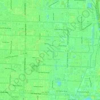
Nom : Carte topographique Palm Springs, altitude, relief.
Lieu : Palm Springs, Palm Beach County, Florida, United States (26.61482 -80.11249 26.66627 -80.08007)
Altitude moyenne : 9 m
Altitude minimum : 1 m
Altitude maximum : 11 m
Faire un don
Équipez-vous pour votre prochaine aventure :
En tant que Partenaire Amazon, ce site perçoit une commission sur les achats éligibles sans surcoût pour vous.