Géolocaliser

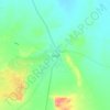
Carte topographique El Arish

Cliquez sur la carte pour afficher l’altitude.

À propos de cette carte

Nom : Carte topographique El Arish, altitude, relief.

Lieu : El Arish, North Sinai, Egypt (31.05800 33.67675 31.16168 33.86818)

Altitude moyenne : 29 m

Altitude minimum : -1 m

Altitude maximum : 115 m

Autres cartes topographiques

Cliquez sur une carte pour visualiser sa topographie, son altitude et son relief.
Lake Bardawil

Egypt > North Sinai

Altitude moyenne : 37 m

Lake Bardawil

Egypt > North Sinai

Altitude moyenne : 37 m

Nekhel

Egypt > North Sinai

Nikhel (Arabic: نِخِل ; also spelled and pronounced Nikhl ) is administratively a city (though realistically more of a town) and the capital of the eponymous markaz (county) North Sinai Governorate, Egypt. It is located in the heart of the Sinai Peninsula bordered to its south by the South Sinai…

Altitude moyenne : 439 m
Lake Bardawil

Egypt > North Sinai

Altitude moyenne : 37 m

El Gorah

Egypt > North Sinai

Altitude moyenne : 87 m

El Hassana

Egypt > North Sinai

Altitude moyenne : 243 m

Bir al Abd

Egypt > North Sinai

Altitude moyenne : 10 m

Équipez-vous pour votre prochaine aventure :

🧼Serviette Microfibre - Séchage rapide et encombrement minimal.
🛡️Casque de VTT - Protection indispensable pour vos descentes en forêt.
📚Guides Randonnée Luxembourg - Découvrez les meilleurs sentiers du Grand-Duché.
⛸️Crampons de Chaussures - Sécurité antidérapante sur les sentiers verglacés.
🍼Gourde Isotherme - Garde vos boissons fraîches ou chaudes pendant 24 heures.

En tant que Partenaire Amazon, ce site perçoit une commission sur les achats éligibles sans surcoût pour vous.