
Carte topographique 丽江市
Carte interactive
Cliquez sur la carte pour afficher l’altitude.
À propos de cette carte
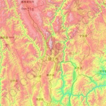
Nom : Carte topographique 丽江市, altitude, relief.
Lieu : 丽江市, 云南省, 中国 (25.98858 99.38218 27.92759 101.51230)
Altitude moyenne : 2 735 m
Altitude minimum : 1 096 m
Altitude maximum : 5 476 m
丽江处于青藏高原与云贵高原的衔接地段,市区古城区在丽江坝子(或丽江坝区)内。丽江地貌多样,有雪山、草甸等自然景观,且因丽江各地地形状况和热力状况迥异,故该市各区域小气候十分显著。
Autres cartes topographiques
Cliquez sur une carte pour visualiser sa topographie, son altitude et son relief.
西双版纳热带植物园-百竹园
西双版纳热带植物园-百竹园, 勐仑镇, 勐腊县, 西双版纳傣族自治州, 云南省, 666100, 中国
Altitude moyenne : 559 m