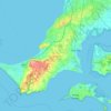
Carte topographique Powers Lookout
Cliquez sur la carte pour afficher l’altitude.
À propos de cette carte

Nom : Carte topographique Powers Lookout, altitude, relief.
Altitude moyenne : 512 m
Altitude minimum : 303 m
Altitude maximum : 798 m
Autres cartes topographiques
Cliquez sur une carte pour visualiser sa topographie, son altitude et son relief.
City of Melbourne
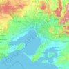
Melbourne's topography is characterized by a diverse landscape that transitions from flat coastal plains to rolling hills and mountainous regions. The city is situated at the northern end of Port Phillip Bay, where the terrain is predominantly flat, facilitating urban development. As one moves eastward, the…
Altitude moyenne : 18 m
Melbourne
Melbourne is also prone to isolated convective showers forming when a cold pool crosses the state, especially if there is considerable daytime heating. These showers are often heavy and can include hail, squalls, and significant drops in temperature, but they often pass through very quickly with a rapid…
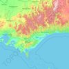
Altitude moyenne : 185 m












Bairnsdale
A comprehensive geological survey of Victoria's Great Dividing Range reveals a distinct north-south alignment in its bedrock, a vestige of the bygone epochs of plate tectonics. This enduring geological framework, coupled with ongoing tectonic activity, contributes to the dynamic topography witnessed in the…
Altitude moyenne : 25 m
Port Phillip
Port Phillip's mostly flat topography and moderate waves make perfect conditions for recreational swimming, kitesurfing, windsurfing, sailing, boating, snorkeling, scuba diving, stand up paddle boarding (SUP) and other sports.
Altitude moyenne : 18 m



Collingwood
Collingwood's topography is mostly flat, but a prominent slope extends from Hoddle Street up to Smith Street, and also along sections of Hoddle Street.
Altitude moyenne : 30 m



Grampians National Park
Mount William is known within the gliding community for the "Grampians Wave", a weather phenomenon that sometimes enables glider pilots to reach extreme altitudes of the order of 28,000 ft (8,500 m). This predominantly occurs during the months of May, June, September and October when strong westerly winds flow…
Altitude moyenne : 262 m


Heywood
Heywood (/ˈheɪwʊd/ HAY-wuud) is a town on the Fitzroy River in the Australian state of Victoria. It is situated at an elevation of 27 metres amidst rolling green hills in an agricultural, pastoral and timbercutting district. Heywood is 357 kilometres (222 mi) west of Melbourne at the intersection of the…
Altitude moyenne : 63 m

King Valley
The King Valley has a history which includes bushrangers, Chinese and Italian immigration. The Chinese migrants came from the Goldfields in the mid-19th century and began careers as market gardeners, tobacco growers and merchants. Many roads in the Valley today carry the names of the more prominent families…
Altitude moyenne : 295 m

Forrest
Hemmed in by a rising ocean that stabilised about 7000 years ago, the uplifted sedimentary rocks of the Otway Range run from north-east to south-west at an elevation of about 500 metres above the sea. A few isolated peaks reach up to 675 metres, and at many points along this coastline bare mountains and…
Altitude moyenne : 212 m