
Carte topographique June Lake
Carte interactive
Cliquez sur la carte pour afficher l’altitude.
À propos de cette carte
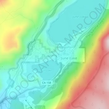
Nom : Carte topographique June Lake, altitude, relief.
Lieu : June Lake, Mono County, California, 93529, United States (37.77480 -119.08879 37.78380 -119.07132)
Altitude moyenne : 2 445 m
Altitude minimum : 2 284 m
Altitude maximum : 2 764 m
June Lake is a census-designated place in Mono County, California. It is located against the southern rim of the Mono Basin, 12.5 miles (20 km) south of Lee Vining, at an elevation of 7654 feet (2333 m).