
Carte topographique Cairnhill Woods
Carte interactive
Cliquez sur la carte pour afficher l’altitude.
À propos de cette carte
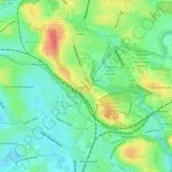
Nom : Carte topographique Cairnhill Woods, altitude, relief.
Altitude moyenne : 39 m
Altitude minimum : 17 m
Altitude maximum : 75 m
Autres cartes topographiques
Cliquez sur une carte pour visualiser sa topographie, son altitude et son relief.
Forth and Clyde Canal Glasgow Spur Towpath
United Kingdom > Scotland > Glasgow City > Glasgow
Forth and Clyde Canal Glasgow Spur Towpath, Craighall, Rockvilla, Glasgow, Glasgow City, Scotland, G4 9SL, United Kingdom
Altitude moyenne : 43 m