
Carte topographique Renukut
Carte interactive
Cliquez sur la carte pour afficher l’altitude.
À propos de cette carte
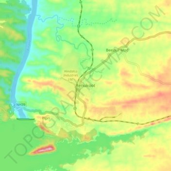
Nom : Carte topographique Renukut, altitude, relief.
Altitude moyenne : 285 m
Altitude minimum : 194 m
Altitude maximum : 423 m
Renukoot is located at 24°12′N 83°02′E / 24.2°N 83.03°E / 24.2; 83.03. It has an average elevation of 283 metres (931 feet). Renukoot lies in the southeast-most part of Uttar Pradesh and sits next to Shakti Nagar, Anpara, ((Dalla)) and Obra. Renukoot is in Sonebhadra district which is the only district in India which borders four states, namely Madhya Pradesh, Chhattisgarh, Jharkhand, and Bihar.