
Carte topographique Ballyholland Lower
Carte interactive
Cliquez sur la carte pour afficher l’altitude.
À propos de cette carte
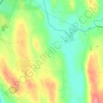
Nom : Carte topographique Ballyholland Lower, altitude, relief.
Altitude moyenne : 60 m
Altitude minimum : 14 m
Altitude maximum : 118 m
Autres cartes topographiques
Cliquez sur une carte pour visualiser sa topographie, son altitude et son relief.
Mourne Mountains West
United Kingdom > Northern Ireland > Newry
Mourne Mountains West, Newry, County Down, Northern Ireland, United Kingdom
Altitude moyenne : 272 m
Newry
United Kingdom > Northern Ireland > Newry
Newry, County Down, Northern Ireland, BT35 6BH, United Kingdom
Altitude moyenne : 129 m
Lisdrumgullion
United Kingdom > Northern Ireland > Newry
Lisdrumgullion, Newry, County Down, Northern Ireland, BT35 6BH, United Kingdom
Altitude moyenne : 41 m