Géolocaliser

Carte topographique Distington

Carte interactive

Cliquez sur la carte pour afficher l’altitude.

À propos de cette carte

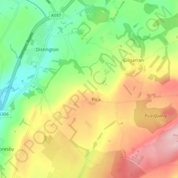
Nom : Carte topographique Distington, altitude, relief.

Lieu : Distington, Borough of Copeland, Cumbria, England, United Kingdom (54.56589 -3.55713 54.60734 -3.48533)

Altitude moyenne : 130 m

Altitude minimum : 36 m

Altitude maximum : 242 m

Autres cartes topographiques

Cliquez sur une carte pour visualiser sa topographie, son altitude et son relief.

Redhills Quarry (disused, flooded)

United Kingdom > England > Cumbria > Borough of Copeland > Millom > Rottington

Redhills Quarry (disused, flooded), Rottington, Millom, Borough of Copeland, Cumbria, England, United Kingdom

Altitude moyenne : 6 m

Sca Fell

United Kingdom > England > Cumbria > Borough of Copeland

Sca Fell, Borough of Copeland, Cumbria, England, CA20 1EX, United Kingdom

Altitude moyenne : 619 m

Mosedale

United Kingdom > England > Cumbria > Borough of Copeland

Mosedale, Wasdale, Borough of Copeland, Cumbria, England, CA20 1EX, United Kingdom

Altitude moyenne : 405 m

Ravenglass

United Kingdom > England > Cumbria > Borough of Copeland

Ravenglass, Borough of Copeland, Cumbria, England, CA18 1SE, United Kingdom

Altitude moyenne : 21 m

Blea Tarn

United Kingdom > England > Cumbria > Borough of Copeland > Boot > Beckfoot

Blea Tarn, Beckfoot, Eskdale, Boot, Borough of Copeland, Cumbria, England, United Kingdom

Altitude moyenne : 144 m

Bigrigg

United Kingdom > England > Cumbria > Borough of Copeland

Bigrigg, Borough of Copeland, Cumbria, England, CA22 2TJ, United Kingdom

Altitude moyenne : 75 m