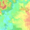
Carte topographique Bald Head
Cliquez sur la carte pour afficher l’altitude.
À propos de cette carte

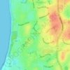
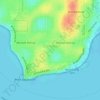
Nom : Carte topographique Bald Head, altitude, relief.
Lieu : Bald Head, City Of Albany, Western Australia, Australia (-35.10679 118.01858 -35.10669 118.01868)
Altitude moyenne : 15 m
Altitude minimum : -1 m
Altitude maximum : 228 m
Autres cartes topographiques
Cliquez sur une carte pour visualiser sa topographie, son altitude et son relief.
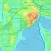






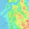



Ellenbrook
The suburb sits in the south-east corner of the Gnangara Mound, close to the Darling Scarp. Topographically, the majority of Ellenbrook's area sits between 40-50 metres above sea level on the mound, with parts of Coolamon and Malvern Springs situated on hills that reach peaks of 65 metres. The northern village…
Altitude moyenne : 49 m