Géolocaliser

Carte topographique Rowington

Cliquez sur la carte pour afficher l’altitude.

À propos de cette carte

Nom : Carte topographique Rowington, altitude, relief.

Lieu : Rowington, Warwick, Warwickshire, England, United Kingdom (52.28278 -1.74189 52.33775 -1.67533)

Altitude moyenne : 110 m

Altitude minimum : 73 m

Altitude maximum : 140 m

Autres cartes topographiques

Cliquez sur une carte pour visualiser sa topographie, son altitude et son relief.
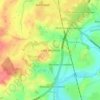
Chessetts Wood

United Kingdom > England > Warwickshire > Warwick > Lapworth

Altitude moyenne : 115 m

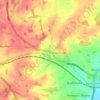
Leek Wootton

United Kingdom > England > Warwickshire > Warwick

Altitude moyenne : 76 m

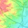
Catchem's End

United Kingdom > England > Warwickshire > Warwick > Hatton

Altitude moyenne : 98 m

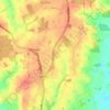
Pinley Green

United Kingdom > England > Warwickshire > Warwick > Rowington

Altitude moyenne : 110 m

Haseley Knob

United Kingdom > England > Warwickshire > Warwick > Wroxall

Altitude moyenne : 117 m

Équipez-vous pour votre prochaine aventure :

🗺️Atlas géographiques - Ouvrages cartographiques détaillés
🧦Chaussettes de randonnée - Chaussettes techniques anti-ampoules
🌂Parapluie de Marche - Alternative à la veste pour rester au sec sans transpirer.
🧊Glacières portables - Conservation aliments en extérieur
🧼Filtres à eau - Systèmes de filtration pour eau potable

En tant que Partenaire Amazon, ce site perçoit une commission sur les achats éligibles sans surcoût pour vous.