
Carte topographique Icklesham
Carte interactive
Cliquez sur la carte pour afficher l’altitude.
À propos de cette carte
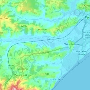
Nom : Carte topographique Icklesham, altitude, relief.
Lieu : Icklesham, Rother District, East Sussex, England, United Kingdom (50.90098 0.63598 50.94599 0.77641)
Altitude moyenne : 26 m
Altitude minimum : -2 m
Altitude maximum : 169 m
Autres cartes topographiques
Cliquez sur une carte pour visualiser sa topographie, son altitude et son relief.
Brede
United Kingdom > England > East Sussex > Rother District
Brede, Rother District, East Sussex, England, United Kingdom
Altitude moyenne : 40 m
Bewl Water
United Kingdom > England > East Sussex > Rother District > Ticehurst
Bewl Water, Ticehurst, Rother District, East Sussex, South East England, England, United Kingdom
Altitude moyenne : 92 m
Fairlight
United Kingdom > England > East Sussex > Rother District
Fairlight, Rother District, East Sussex, England, United Kingdom
Altitude moyenne : 47 m