Géolocaliser

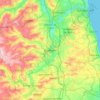
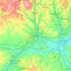
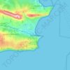
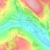
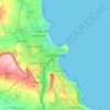
Carte topographique North Tyneside

Cliquez sur la carte pour afficher l’altitude.

À propos de cette carte

Nom : Carte topographique North Tyneside, altitude, relief.

Lieu : North Tyneside, North East, England, United Kingdom (54.98292 -1.63975 55.07673 -1.40277)

Altitude moyenne : 35 m

Altitude minimum : -4 m

Altitude maximum : 88 m

Autres cartes topographiques

Cliquez sur une carte pour visualiser sa topographie, son altitude et son relief.
London

United Kingdom > England > London

Altitude moyenne : 42 m

Durham

United Kingdom > England > County Durham

Altitude moyenne : 119 m

Leeds

United Kingdom > England

Lying in the eastern foothills of the Pennines, there is a significant variation in elevation within the city's built-up area. The district ranges from 1,115 feet (340 m) in the far west on the slopes of Ilkley Moor to about 33 feet (10 m) where the rivers Aire and Wharfe cross the eastern boundary. Land rises…

Altitude moyenne : 94 m

St Austell

United Kingdom > England > St Austell

Altitude moyenne : 104 m

Capesthorne

United Kingdom > England > Cheshire East > Siddington

Altitude moyenne : 93 m

Ilkley Moor

United Kingdom > England > Bradford

Altitude moyenne : 256 m

Penryn

United Kingdom > England > Penryn

Altitude moyenne : 64 m

Brighton

United Kingdom > England > Brighton and Hove

Altitude moyenne : 64 m

Cambridge

United Kingdom > England > Cambridge

The city, like most of the UK, has a maritime climate highly influenced by the Gulf Stream. Located in the driest region of Britain, Cambridge's rainfall averages around 570 mm (22.44 in) per year, around half the national average, with some years occasionally falling into the semi-arid (under 500 mm (19.69…

Altitude moyenne : 18 m
South Mimms

United Kingdom > England > Hertfordshire > Hertsmere

Altitude moyenne : 102 m

Hull

United Kingdom > England > Kingston upon Hull

Kingston upon Hull is on the northern bank of the Humber Estuary. The city centre is west of the River Hull and close to the Humber. The city is built upon alluvial and glacial deposits which overlie chalk rocks but the underlying chalk has no influence on the topography. The land within the city is generally…

Altitude moyenne : 21 m
Worksop

United Kingdom > England > Nottinghamshire > Bassetlaw

Altitude moyenne : 56 m

Newport

United Kingdom > England > Telford and Wrekin

Altitude moyenne : 81 m

Harker

United Kingdom > England > Cumberland

Altitude moyenne : 24 m

Gateshead

United Kingdom > England > Tyne and Wear > Gateshead

One of the most distinguishing features of Gateshead is its topography. The land rises 230 feet (70 m) from Gateshead Quays to the town centre and continues rising to a height of 525 feet (160 m) at Queen Elizabeth Hospital in Sheriff Hill. This is in contrast to the flat and low lying Team Valley located on…

Altitude moyenne : 62 m
Salcombe

United Kingdom > England > South Hams > Salcombe

Altitude moyenne : 47 m

Ledbury

United Kingdom > England > Ledbury

Altitude moyenne : 88 m

Hemel Hempstead

United Kingdom > England > Hertfordshire > Dacorum

Altitude moyenne : 130 m

Brighton

United Kingdom > England > Brighton and Hove

Altitude moyenne : 28 m

Taunton

United Kingdom > England > Somerset

Altitude moyenne : 39 m

Leicester

United Kingdom > England > City of Leicester

Altitude moyenne : 109 m

Warren Wood

United Kingdom > England > Greater London

Altitude moyenne : 35 m

Boothstown

United Kingdom > England > Salford

Altitude moyenne : 41 m

Ipswich

United Kingdom > England > Suffolk > Ipswich

Ipswich experiences an oceanic climate, like the rest of the British Isles, with a narrow range of temperature and rainfall spread evenly throughout the year. One of the two nearest for which data is available is East Bergholt, about 7 miles (11 km) south west of the town centre and at a similar elevation, and…

Altitude moyenne : 30 m
Ashford

United Kingdom > England > Kent > Ashford

Altitude moyenne : 49 m

Rowlands Gill

United Kingdom > England > Tyne and Wear > Gateshead

Altitude moyenne : 105 m

Beacon Hill

United Kingdom > England > Hampshire > Hart

Altitude moyenne : 139 m

Guildford

United Kingdom > England > Surrey > Guildford

Altitude moyenne : 64 m

Camberwell Green

United Kingdom > England > London > Brixton

Altitude moyenne : 12 m

Meadowfield

United Kingdom > England > County Durham

Altitude moyenne : 98 m

Rainham

United Kingdom > England > Kent

Altitude moyenne : 52 m

Brownsea Island

United Kingdom > England > Dorset > Poole

Altitude moyenne : 3 m

Isles of Scilly

United Kingdom > England

Altitude moyenne : 2 m

Yeovil

United Kingdom > England > Yeovil

Altitude moyenne : 58 m

Falmouth

United Kingdom > England > Falmouth

Altitude moyenne : 33 m

Altrincham

United Kingdom > England > Trafford

Altitude moyenne : 37 m

Morley

United Kingdom > England > Leeds > Morley

Altitude moyenne : 111 m

Tipner

United Kingdom > England > Portsmouth

Altitude moyenne : 3 m

Foxhole

United Kingdom > England > Cornwall

Altitude moyenne : 182 m

York

United Kingdom > England > York

Altitude moyenne : 21 m

Slough

United Kingdom > England > Berkshire

Altitude moyenne : 34 m

Reading

United Kingdom > England > Reading

Mary Russell Mitford lived in Reading for a number of years and then spent the rest of her life just outside the town at Three Mile Cross and Swallowfield. The fictional Belford Regis of her eponymous novel, first published in 1835, is largely based on Reading. Described with topographical accuracy, it is…

Altitude moyenne : 56 m

Aspull

United Kingdom > England > Wigan

Altitude moyenne : 111 m

Portishead

United Kingdom > England > Portishead

Altitude moyenne : 26 m

Bognor Regis

United Kingdom > England > Bognor Regis

Altitude moyenne : 2 m

Battle

United Kingdom > England > Rother > Battle

Altitude moyenne : 64 m

St Albans

United Kingdom > England > Hertfordshire > St Albans

St Albans was an ancient borough created following the dissolution of the monastery in 1539. It consisted of the ancient parish of St Albans (also known as the Abbey parish) and parts of St Michael and St Peter. The municipal corporation was reformed by the Municipal Corporations Act 1835 and the boundary was…

Altitude moyenne : 100 m
Derby

United Kingdom > England > Derbyshire

Altitude moyenne : 97 m

Low Hutton

United Kingdom > England > North Yorkshire

Altitude moyenne : 44 m

Sticker

United Kingdom > England > Cornwall

Altitude moyenne : 85 m

Erith

United Kingdom > England

Altitude moyenne : 17 m

Pensby

United Kingdom > England

Altitude moyenne : 63 m

Beacon Hill

United Kingdom > England > Norfolk > North Norfolk

Beacon Hill is a part of the Cromer Ridge which is a ridge of old glacial moraines (terminal moraine) that stands next to the coast above Cromer. The Cromer Ridge seems to have been the front line of the ice sheet for some time at the last glaciations, which is shown by the large size of the feature. All the…

Altitude moyenne : 65 m

Otley

United Kingdom > England > Leeds

Altitude moyenne : 84 m

Ealing

United Kingdom > England > Greater London

Altitude moyenne : 26 m

Batley

United Kingdom > England > Kirklees

Altitude moyenne : 111 m

Lympstone

United Kingdom > England > Lympstone

Altitude moyenne : 22 m

Swanage

United Kingdom > England > Swanage

Altitude moyenne : 28 m

Romford

United Kingdom > England > Greater London

The town centre is about 50 feet (15 m) above sea level on a gravel terrace rising from the River Thames. The north of the town has developed on London Clay and is situated as much as 150 ft (46 m) above sea level. A continuous gentle rise in the eastern suburbs towards Gidea Park and Harold Wood peaks around…

Altitude moyenne : 29 m

Totnes

United Kingdom > England > Totnes

Altitude moyenne : 64 m

Kendal

United Kingdom > England > South Lakeland > Kendal

Altitude moyenne : 112 m

Tonbridge

United Kingdom > England > Kent > Tonbridge and Malling

Altitude moyenne : 52 m

Aylesbury

United Kingdom > England > Aylesbury

Aylesbury is immediately southeast of the upper River Thame that flows past Thame to Dorchester on Thames and is partly sited on the two northernmost outcrops of Portland (lime)stone in England bisected by a small stream, Bear Brook which gives a relatively prominent position in relation to the terrain of all…

Altitude moyenne : 84 m

Drimpton

United Kingdom > England > Dorset

Altitude moyenne : 125 m

Bolton

United Kingdom > England > Bolton

Altitude moyenne : 135 m

Sunderland

United Kingdom > England > Tyne and Wear

Altitude moyenne : 38 m

Salford

United Kingdom > England

At 53°28′59″N 2°17′35″W / 53.48306°N 2.29306°W / 53.48306; -2.29306 (53.483°, −2.2931°), and 205 miles (330 km) northwest of central London, Salford stands about 177 feet (54 m) above sea level, on relatively flat ground to the west of a meander of the River Irwell – the city's main…

Altitude moyenne : 106 m
Chopwell

United Kingdom > England > Gateshead

Altitude moyenne : 153 m

Havant

United Kingdom > England > Hampshire > Havant

Altitude moyenne : 17 m

Stake Hill

United Kingdom > England > Middleton

Altitude moyenne : 140 m

Horsenden Hill

United Kingdom > England > London

The base of this isolated hill is at an altitude of approximately 50 metres. Like all of the immediately surrounding area, the base of the hill, as well as the slopes of the hill up to about 70m, are on London Clay. Between about 70m and 80m is an isolated layer of sandier Claygate Beds. Both deposits are of…

Altitude moyenne : 40 m

Wainscott

United Kingdom > England > Medway

Altitude moyenne : 26 m

Diggle

United Kingdom > England > Oldham

Altitude moyenne : 295 m

Allestree Park

United Kingdom > England > Derby > Derby

Altitude moyenne : 85 m

Lords Wood

United Kingdom > England > Medway

Altitude moyenne : 134 m

Weardale

United Kingdom > England > County Durham > Stanhope

Altitude moyenne : 260 m

Mount Hawke

United Kingdom > England > Cornwall

Altitude moyenne : 101 m

Goosnargh

United Kingdom > England > Lancashire > Preston

Altitude moyenne : 67 m

Devonport Park

United Kingdom > England > Plymouth

Altitude moyenne : 15 m

Scarborough

United Kingdom > England > North Yorkshire

The climate is temperate with mild summers and cool, windy, winters. The hottest months of the year are July and August, with temperatures reaching an average high of 17 °C and falling to 11 °C at night. The average daytime temperatures in January are 4 °C, falling to 1 °C at night. The station's elevation…

Altitude moyenne : 39 m

Peel Park

United Kingdom > England > Salford

Altitude moyenne : 36 m

Westmarsh

United Kingdom > England > Kent > Dover > Ash

Altitude moyenne : 8 m

Great Leighs

United Kingdom > England > Essex > Chelmsford

Altitude moyenne : 62 m

Coventry

United Kingdom > England

Altitude moyenne : 100 m

Équipez-vous pour votre prochaine aventure :

🛌Sac de Couchage - Isolation thermique performante pour vos nuits en altitude.
🔦Lampe Frontale - Éclairage puissant pour vos marches nocturnes ou le camping.
🧢Chapeaux de randonnée - Protection solaire pour marche et trekking
🎒Poche à Eau - Réservoir d'eau avec tuyau pour s'hydrater sans s'arrêter.
🧳Sacs de voyage outdoor - Sacs résistants pour voyages nature

En tant que Partenaire Amazon, ce site perçoit une commission sur les achats éligibles sans surcoût pour vous.