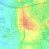
Carte topographique Haxey
Cliquez sur la carte pour afficher l’altitude.
Haxey
The civil parish includes the town of Haxey and village of Westwoodside, and the hamlets of High Burnham (the highest elevation of the Isle of Axholme), Low Burnham, East Lound, Graizelound and Upperthorpe which is conjoined to Westwoodside.
À propos de cette carte

Nom : Carte topographique Haxey, altitude, relief.
Lieu : Haxey, North Lincolnshire, England, United Kingdom (53.46027 -0.92062 53.52115 -0.78842)
Altitude moyenne : 7 m
Altitude minimum : -4 m
Altitude maximum : 42 m
Autres cartes topographiques
Cliquez sur une carte pour visualiser sa topographie, son altitude et son relief.