
Carte topographique Lolland Kommune
Carte interactive
Cliquez sur la carte pour afficher l’altitude.
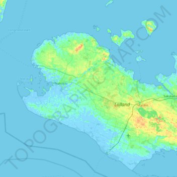
Carte topographique Lolland Kommune, altitude, relief
À propos de cette carte
Nom : Carte topographique Lolland Kommune, altitude, relief.
Lieu : Lolland Kommune, Region Sjælland, Danemark (54.59375 10.95471 55.04031 11.57861)
Altitude moyenne : 2 m
Altitude minimum : -6 m
Altitude maximum : 25 m
Autres cartes topographiques
Cliquez sur une carte pour visualiser sa topographie, son altitude et son relief.