
Carte topographique Ardihannon
Carte interactive
Cliquez sur la carte pour afficher l’altitude.
À propos de cette carte
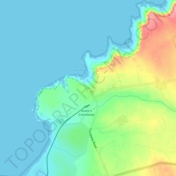
Nom : Carte topographique Ardihannon, altitude, relief.
Altitude moyenne : 28 m
Altitude minimum : -1 m
Altitude maximum : 113 m
Autres cartes topographiques
Cliquez sur une carte pour visualiser sa topographie, son altitude et son relief.
Ballylinny
United Kingdom > Northern Ireland > Bushmills
Ballylinny, Bushmills, County Antrim, Northern Ireland, United Kingdom
Altitude moyenne : 34 m
Castlecat
United Kingdom > Northern Ireland > Bushmills
Castlecat, Bushmills, County Antrim, Northern Ireland, United Kingdom
Altitude moyenne : 57 m