
Carte topographique Handwara
Carte interactive
Cliquez sur la carte pour afficher l’altitude.
Handwara
Handwara is located at 34°24′N 74°17′E / 34.40°N 74.28°E / 34.40; 74.28 at an average elevation of 1,582 metres (5,190 feet) above sea level.
À propos de cette carte
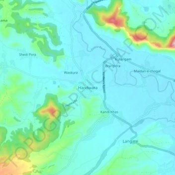
Nom : Carte topographique Handwara, altitude, relief.
Altitude moyenne : 1 638 m
Altitude minimum : 1 586 m
Altitude maximum : 1 931 m