
Carte topographique 定州市
Carte interactive
Cliquez sur la carte pour afficher l’altitude.
À propos de cette carte
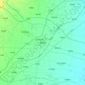
Nom : Carte topographique 定州市, altitude, relief.
Lieu : 定州市, 保定市, 河北省, 中国 (38.35122 114.83700 38.67122 115.15700)
Altitude moyenne : 56 m
Altitude minimum : 35 m
Altitude maximum : 191 m
河北省中部偏西,平均海拔43.6米,年均日照2611.9小时,年均气温为12.4℃,年际间气温差异不大。年均地面温度为19.6℃;年均降水量为503.2毫米。全年多起东北风。
Autres cartes topographiques
Cliquez sur une carte pour visualiser sa topographie, son altitude et son relief.