Géolocaliser

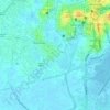
Carte topographique Kooroppada

Cliquez sur la carte pour afficher l’altitude.

À propos de cette carte

Nom : Carte topographique Kooroppada, altitude, relief.

Lieu : Kooroppada, Kottayam, Kerala, 686502, India (9.57853 76.62564 9.61853 76.66564)

Altitude moyenne : 65 m

Altitude minimum : 24 m

Altitude maximum : 134 m

Autres cartes topographiques

Cliquez sur une carte pour visualiser sa topographie, son altitude et son relief.
Alapuzha

India > Kerala > Kottayam > Kottayam

Altitude moyenne : 10 m

Karapuzha

India > Kerala > Kottayam > Kottayam

Altitude moyenne : 7 m

Sankranthi

India > Kerala > Kottayam > Kottayam

Altitude moyenne : 15 m

Meenadom

India > Kerala > Kottayam > Pariyaram

Altitude moyenne : 36 m

Manimala River

India > Kerala > Kottayam > Eravinalloor

Altitude moyenne : 12 m

Kanjikuzhy

India > Kerala > Kottayam > Manganam

Altitude moyenne : 14 m

Meenachil

India > Kerala > Kottayam > Pulikuttisseri

Altitude moyenne : 7 m

child

India > Kerala > Kottayam > Thiruvanchoor

Altitude moyenne : 13 m

Alapuzha

India > Kerala > Kottayam > Kottayam

Altitude moyenne : 10 m

Alapuzha

India > Kerala > Kottayam > Kottayam

Altitude moyenne : 10 m

Équipez-vous pour votre prochaine aventure :

🕯️Lanterne de Camp - Éclairage d'ambiance à 360 degrés pour la tente.
🦯Bâtons de Marche - Bâtons télescopiques légers pour soulager les articulations en descente.
🛑Sifflets de survie - Accessoires de signalisation sonore
🧴Crèmes solaires outdoor - Protection UV pour activités prolongées
🐕Harnais Chien Outdoor - Emmenez votre compagnon sur les sentiers luxembourgeois.

En tant que Partenaire Amazon, ce site perçoit une commission sur les achats éligibles sans surcoût pour vous.