Géolocaliser

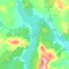
Carte topographique Gatehead

Cliquez sur la carte pour afficher l’altitude.

À propos de cette carte

Nom : Carte topographique Gatehead, altitude, relief.

Lieu : Gatehead, East Ayrshire, Scotland, KA2 0AN, United Kingdom (55.57477 -4.57344 55.61477 -4.53344)

Altitude moyenne : 32 m

Altitude minimum : 10 m

Altitude maximum : 65 m

Autres cartes topographiques

Cliquez sur une carte pour visualiser sa topographie, son altitude et son relief.

Braid Wood

United Kingdom > Scotland > East Ayrshire

Altitude moyenne : 114 m

Glenbuck Loch

United Kingdom > Scotland > East Ayrshire

Altitude moyenne : 327 m

Loch Doon

United Kingdom > Scotland > East Ayrshire

Altitude moyenne : 291 m

River Doon

United Kingdom > Scotland > East Ayrshire > Dalrymple

Altitude moyenne : 168 m

River Ayr

United Kingdom > Scotland > East Ayrshire

Altitude moyenne : 210 m

Fenwick Moor

United Kingdom > Scotland > East Ayrshire > Kingsford

Altitude moyenne : 192 m

Équipez-vous pour votre prochaine aventure :

📦Boîtes étanches - Protection étanche pour objets sensibles
👕T-shirt Laine Mérinos - Régulation thermique naturelle et anti-odeurs.
🛑Sifflets de survie - Accessoires de signalisation sonore
🏕️Tentes de camping - Tentes résistantes pour camping, bivouac et trekking
🧢Bonnets en laine - Protection thermique naturelle

En tant que Partenaire Amazon, ce site perçoit une commission sur les achats éligibles sans surcoût pour vous.